We're using a ground sensors, drones, mobile data, and AI to understand tree health and socio-ecological parameters in urban green spaces.
Things used in this project
Hardware components
Software apps and online services
python
Microsoft Azure IoT Hub
influxDB
Grafana
Microsoft Custom Vision
Story
We're a research team at the University of British Columbia from Electrical and Computer Engineering and Forestry. We're studying tree health and the associated social and ecological values within urban green spaces.
We're using a combination of technologies in our study, including IoT sensors, drones, mobile data, and AI to build our IoT/AI cloud-cellular solution architecture.
The data is sent to Azure IoT Hub and to open-source tools for data storage and visualization, including InfluxDB and Grafana.
More info here:
http://brianchami.com/index.php/natural-assets/
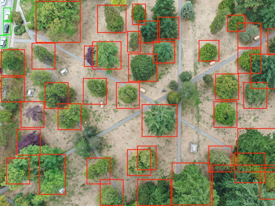
We're also teaching a work session series on Drones + Custom Vision [Funded by NRCan], where we teach participants:
Introduction to drones and Drone data types Drones in Sustainability and Urban Green Spaces Intro to Custom Vision Training a Custom Vision Model to count and classify tree types Deploy the model on a user-friendly webapp to potentially be used by practitioners, city planners and mangers, community leaders.
The idea is use tech to engage cities and communities, especially remote communities that lack the necessary tools and expertise in data analysis.
Work Session Link:
https://aggregate-intellect.notion.site/Drone-Image-Classification-of-Urban-Green-spaces-214499d7dc4840e0a69ea556963421b8
We're also thinking about integrating the system with a Custom Vision-based tool for wildlife monitoring. [if there's enough time]:
http://brianchami.com/index.php/cameratrap/